
When Minutes Decide the Outcome
A wildfire can double in size in under an hour. A lava dome can collapse without warning. A flood can rise meters overnight while a region sleeps. In every one of these scenarios, the gap between “we think something is happening” and “we know exactly where and how big” is the gap between a contained incident and a catastrophe.
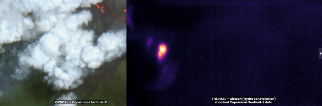
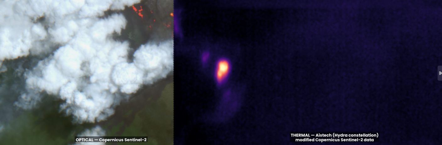
Thermal satellites close that gap. By sensing heat instead of light, they see fires, lava and temperature anomalies that are invisible to normal cameras, day or night, through smoke and light clouds. For emergency teams, that means something simple and valuable: more time to act.
How Thermal Satellites “See” a Disaster
Unlike optical cameras, thermal sensors don’t need visible light. They detect infrared radiation emitted by hot surfaces, which is why they can spot an active fire through smoke or in total darkness.
The detection threshold is low compared to what’s burning: dry fuels ignite around 280°C, and an established wildfire can exceed 800°C, so even a small hotspot stands out sharply against the surrounding landscape in a thermal band (NASA Earthdata).
Two public missions have been instrumental for rapid wildfire detection worldwide in recent decades:
| Sensor | Platform | Thermal resolution | Typical latency |
|---|---|---|---|
| MODIS | NASA Terra & Aqua | 1,000 m/pixel | ~3 hours |
| VIIRS | Suomi NPP, NOAA-20/21 | 375 m/pixel | ~3 hours (under 60 seconds for ultra real-time US feeds) |
VIIRS’s finer resolution means it catches many small or low-temperature fires that MODIS misses. Both feed NASA’s FIRMS platform, which has driven detection latency for the continental US down to under a minute for its ultra real-time feed (NASA FIRMS).
Wildfires: Why Detection Speed Is Everything
General-purpose sensors like MODIS and VIIRS were not built just for fire, which is why the industry is moving toward dedicated thermal monitoring built specifically for fast fire detection.
The principle is straightforward: the sooner a hotspot is flagged and located precisely, the sooner ground crews and aircraft can be dispatched to the right coordinates. Onboard detection, where the satellite itself identifies anomalies instead of downlinking raw data for ground processing, cuts that time from hours to minutes. Pairing that with AI filtering, distinguishing a genuine fire from industrial heat or sun glint, means responders get fewer false alarms and more confidence in each one that reaches them.
This is the gap thermal Earth Observation is built to close: precise, fast, reliable heat detection feeding directly into the hands of the people who decide where to send resources.
Volcanoes: Thermal Hotspots as an Early Warning System
Volcano monitoring is where thermal satellites have the strongest, best-documented track record. A rising “hot spot” index, calculated from thermal infrared bands crossing a set threshold, can flag magma movement before an eruption becomes visible from the ground (ESA).
Between 2018 and 2024, the International Charter and Copernicus Emergency Management Service were activated five times specifically for effusive eruptions, including Etna, Soufrière St Vincent, Nyiragongo, La Palma and Wolf. In the Soufrière St Vincent case, NASA’s ASTER and ECOSTRESS instruments tracked the growth of a new lava dome inside the crater, giving responders continuous situational awareness at a remote site with little ground instrumentation (NASA Disasters Mapping Portal).
This matters most precisely where it’s hardest to get boots on the ground: remote volcanoes with sparse seismic networks, where satellite thermal data is sometimes the only real-time signal available.
Floods: Reading Water Through Temperature
Flooded ground has a different thermal signature than dry ground, because water and soil store and release heat differently. Researchers used this after the 2011 Great East Japan Earthquake and tsunami: MODIS land surface temperature data showed flooded areas were measurably warmer at night than surrounding unflooded land, letting analysts estimate the extent of inundation from orbit. A separate study using ASTER thermal bands, comparing before-and-after imagery, found reasonably good agreement with flood maps built from aerial photos and ground surveys.
The practical advantage is timing: a thermal sensor can image at night, when optical cameras are useless, even if at lower spatial resolution. For a flood unfolding in darkness, that’s often the only overhead view available until sunrise.
Why Speed From Orbit Actually Saves Lives
Detection latency has gone from hours (classic MODIS/VIIRS passes) to minutes (FIRMS ultra real-time feeds) to, in pilot programs, something close to real time (onboard detection on dedicated constellations). Each step down in latency is a step up in how much of a disaster is still preventable when responders find out about it.
Operational adoption varies per use case. Wildfire and volcano monitoring have mature, well-documented operational use, with agencies like the International Charter and Copernicus EMS routinely using thermal data. Flood extent estimation from land surface temperature is a validated research technique, though less standardized operationally.
Thermal satellites aren’t a silver bullet for every disaster type, but where the physics and the track record line up, fire and heat above all, they already change outcomes.
Where Aistech Fits In
This is the frontier Aistech Space works on: thermal imaging from orbit, built to turn raw heat data into actionable intelligence for the people who need it fastest, emergency agencies, civil protection teams, insurers and governments. As thermal constellations get denser and detection latency keeps shrinking, the organizations that benefit most will be the ones with infrastructure ready to receive, interpret and act on that data the moment it arrives.
Want to see how thermal satellite data could fit into your organization’s disaster response or monitoring workflow? Get in touch with the Aistech team.